Evaluating Traffic Corridors and Daily Commutes from Exclusive Miami Gated Islands

Quick Summary
- Miami island commutes are defined less by distance than by limited access points
- Venetian, MacArthur, and Rickenbacker shape daily movement to the urban core
- Fisher Island and Key-biscayne face the clearest single-corridor risks
- Toll costs, parking, rain, and rush-hour windows all affect livability
Why commute design matters in ultra-prime Miami
In Miami’s most rarefied residential enclaves, privacy and prestige often come with a transportation trade-off. The question is not simply how far a resident is from Brickell, Downtown, Coral-gables, Wynwood, or Miami International Airport. The more consequential issue is how many access points separate home from the mainland, and how resilient those links remain during rush hour, heavy rain, or a typical weekday filled with meetings, school runs, and airport transfers.
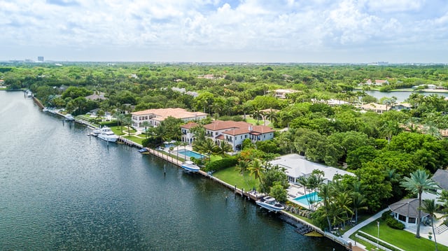
For buyers considering addresses on Fisher-island, Star Island, Palm Island, Hibiscus Island, Venetian Islands, Brickell, or Key-biscayne, daily mobility is best understood through corridor analysis. Exclusive islands are defined by constrained entries and exits. That means a short geographic trip can still become a carefully timed exercise, especially when bridge traffic, toll plazas, ferry schedules, or urban bottlenecks begin to compound.
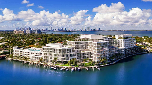
This is one reason commute fluency has become part of the luxury conversation. In practice, a residence can feel materially more convenient when it aligns with a client’s dominant route, whether that is Brickell Avenue for finance and law, US-1 for southbound business, or the I-195 corridor for regular access to the Design District. Buyers comparing island life with mainland alternatives such as Una Residences Brickell or The Residences at Mandarin Oriental, Miami are often evaluating exactly that distinction: scenic separation versus frictionless daily movement.
The corridors that shape island life
For Miami Beach-side islands and nearby luxury addresses, two east-west links dominate the conversation: the Venetian Causeway and the MacArthur Causeway. The Venetian is a key route for residents moving between island neighborhoods and Downtown or Brickell. The MacArthur serves as a major parallel corridor and often becomes the practical alternative when the Venetian is overburdened.
That dual-corridor structure matters because it gives some buyers a measure of optionality. Residents of South-of-fifth and Miami-beach enclaves may not control congestion, but they can sometimes control route selection. That flexibility is part of the appeal of homes positioned near the broader beach-to-mainland network, including properties such as Apogee South Beach and The Perigon Miami Beach, where access planning is inseparable from the lifestyle proposition.
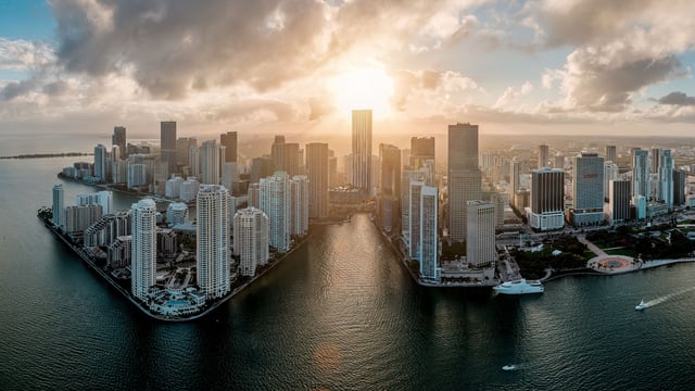
By contrast, Brickell-bound traffic often compresses as drivers filter toward Brickell Avenue and the Downtown interchanges. The distance may be short, but the approach into the urban core can slow at familiar pinch points, particularly around the I-95 and Miami Avenue network. For residents whose calendars are anchored in Downtown towers, private clubs, and waterfront offices, the difference between a theoretically close address and a practically efficient one becomes quite tangible.
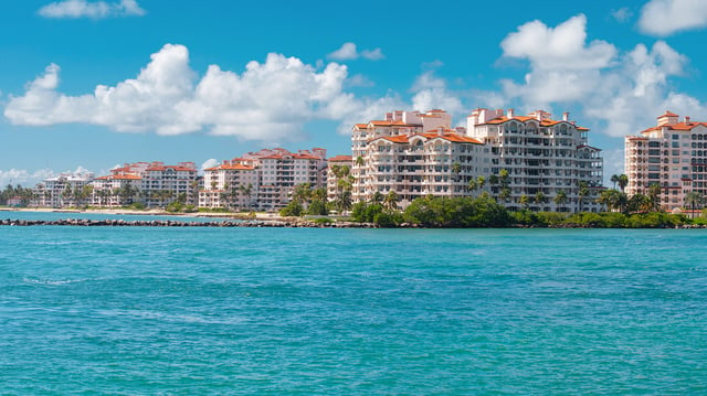
Fisher Island: unmatched privacy, choreographed access
No island illustrates the privilege-versus-logistics equation more clearly than Fisher-island. It has no public road connection, and daily access relies primarily on a private ferry from the mainland near Brickell or by private vessel. For residents, that means the commute begins before the drive itself. Timing the ferry is not an incidental detail; it is the first leg of the journey.
That does not diminish the appeal. If anything, it sharpens the buyer profile. Fisher Island suits those who place a premium on controlled access, insulation, and an almost ceremonial sense of arrival. But it also favors households that can absorb a more managed routine, often with drivers, staff coordination, or flexible scheduling. The lifestyle is beautifully represented by The Links Estates at Fisher Island and The Residences at Six Fisher Island, both of which speak to buyers who understand that true exclusivity in Miami can mean relinquishing road immediacy.
For professionals with frequent Brickell meetings, the mainland ferry terminal location helps. Yet even then, the final approach commonly depends on Brickell Avenue and the same urban arteries that affect nearby mainland residents. Fisher Island is therefore best understood not as an easy daily-drive address, but as a deeply private residential world with a choreographed connection to the city.
Key Biscayne: elegance with a single-corridor reality
Key-biscayne presents a different but equally important access profile. Residents depend on the Rickenbacker Causeway as the principal vehicular link to the mainland, making it both essential and vulnerable. When the corridor moves well, the route feels direct and orderly. When conditions deteriorate, the lack of a true alternative becomes the defining issue.
This single-corridor dependence is central to buyer due diligence. It affects school drop-offs, club schedules, office arrivals, and airport timing. It also carries a recurring cost component because toll infrastructure is part of the route. For frequent commuters, tolls, parking charges in Brickell or Downtown, and the occasional use of express facilities all become part of the real operating cost of island life. SunPass is therefore less a convenience than a basic tool of everyday efficiency.
For buyers weighing island calm against daily movement, nearby luxury options such as Oceana Key Biscayne help frame the decision in practical terms: extraordinary waterfront living, paired with the reality that one corridor governs nearly every mainland trip.
Airport, Coral Gables, and design-driven destinations
Not every luxury commute points to Brickell. Many households divide their movement patterns among Miami International Airport, Coral-gables, and the creative districts north of Downtown. Airport runs commonly route through SR-836 or I-95 depending on final origin and live traffic conditions. That means island residents are not simply solving for one bridge or one boulevard. They are often layering causeways onto regional expressways.
For southbound professional life, Coral-gables is typically approached from the Brickell area via US-1 or SW 8th Street. That makes the transition from an island or waterfront enclave into the Brickell core especially significant. A delayed causeway crossing can ripple through the rest of the journey. Buyers who expect frequent Gables access sometimes compare island addresses with Grove and mainland alternatives such as Vita at Grove Isle or Ponce Park Coral Gables, where the trade-off may favor smoother south-and-west mobility.
Trips to Wynwood and the Design District add another variable. They often rely on the I-195 and Midtown corridor, where congestion can shift quickly. In a city where dinner, art fairs, atelier visits, and board meetings may all coexist in the same week, route volatility matters almost as much as raw distance.
The hidden costs of a beautiful address
In the luxury bracket, commute economics are rarely about fuel alone. They include tolls, parking, valet dependence, the cost of a dedicated driver, and the opportunity cost of rigid departure windows. Because many exclusive islands are not directly served by robust transit options, residents are pushed toward private cars, ride services, ferries, or household transportation staff.
Weather also deserves more attention than it typically receives in glossy marketing copy. Heavy rain and storm conditions can disrupt low-lying roads and causeway travel, introducing variability even into meticulously planned routines. A dry-season commute pattern may feel very different during summer weather cycles.
Hybrid work has softened some of this pressure. Fewer mandatory office days can make an island address far more attractive than it would have been in a five-day commuting model. Still, the structural issue remains the same: limited access points define daily life. Miami’s mobility improvements have generally focused on broader traffic management rather than creating new direct road access for these enclaves. In other words, buyers should assume the fundamental corridor map will continue to matter.
What sophisticated buyers should evaluate before purchasing
The most useful question is not whether an island address is convenient in the abstract. It is whether it is convenient for your exact rhythm. A finance principal working in Brickell, a family with Coral-gables school commitments, and a founder with weekly airport departures will experience the same residence very differently.
Before purchasing, buyers should test their probable routes at realistic hours, account for toll and parking habits, and think carefully about how much schedule control they truly have. For some, the answer will point decisively toward a gated island with a singular sense of privacy. For others, a mainland or edge-of-island position may deliver a better balance of discretion and freedom.
In Miami, the most intelligent luxury purchase is often the one that respects not only the view, but the bridge, boulevard, or ferry behind it.
FAQs
-
Which Miami island has the most constrained daily commute? Fisher-island is among the most constrained because it lacks a public road connection and depends primarily on private ferry access or private vessel arrivals.
-
Is Key-biscayne considered a commute risk for daily drivers? Yes. Its reliance on the Rickenbacker Causeway creates single-corridor exposure that can affect routine trips to the mainland.
-
What are the main corridors for Miami Beach-side island residents? The Venetian Causeway and the MacArthur Causeway are the principal links shaping trips toward Downtown and Brickell.
-
Why can a short Brickell commute still feel slow? Because distance is not the same as flow, and congestion near major Downtown and I-95 interchanges can delay a relatively short trip.
-
How do most island residents reach Miami International Airport? Airport trips commonly connect through SR-836 or I-95, depending on origin, destination, and prevailing traffic conditions.
-
Are tolls part of the lifestyle cost on Key-biscayne? Yes. The Rickenbacker Causeway includes toll infrastructure, so repeat commuters should treat tolls as a recurring ownership expense.
-
Is public transit a strong fallback for exclusive gated islands? Not typically. Many of the most exclusive enclaves are not directly served in a way that replaces private cars, ferries, or ride services.
-
Do weather conditions materially affect luxury commutes in Miami? Yes. Heavy rain and storm events can disrupt low-lying roads and causeway travel, especially on routes with limited alternatives.
-
Is island living easier now that more buyers work hybrid schedules? Often, yes. Reduced commute frequency can make constrained-access addresses more practical, though the corridor limitations still remain.
-
What is the smartest way to judge commute quality before buying? Match the residence to your real weekly routes and test those trips at actual departure times rather than relying on map-distance alone.
To compare the best-fit options with clarity, connect with MILLION Luxury.

Million Luxury
Million Luxury
Welcome to MILLION, an exclusive luxury real estate boutique nestled in the heart of South Florida’s most desirable locations. Specializing in high-end properties, we provide a sanctuary for discerning clients including top Fortune 500 executives, affluent families, celebrities, and professional athletes from across the globe. At MILLION, we understand the unique demands of our elite clientele and offer a seamless blend of confidentiality and personalized attention. Our commitment to privacy is unwavering; we ensure that every transaction and interaction is handled with the utmost discretion and according to stringent confidentiality protocols. Our concierge service embodies the pinnacle of white-glove care, offering tailored assistance that transcends traditional real estate support.